Showing posts with label Moira. Show all posts

10/13/12

#23: One Last Peek at the Bay

We took advantage of fair weather on September 28 to relocate our research vessel to its winter home at James Rich Boatyard in West Tremont, Maine. The good folks there have been taking care of the R/V Nereid since the mid 1990s.  During the off-season, the Nereid will get her usual painting and buffing and as well as a new depth sounder.

The last weekend in Lubec was spent packing up all the research equipment and data. The team headed back to their offices at the Aquarium in Boston on October 1, eager to finish up the season's photo analysis to determine how many individual right whales were accounted for in Fundy. Two of us stayed on for an extra week, hopeful for one more clear day to sneak back out into the Bay to see if there were any lingering right whales. Wednesday, October 3, dawned clear and bright, although with a little more wind than forecast. Amy and Moe borrowed the FRC (Fast Rescue Craft) from the Campobello Whale Rescue Team for one last survey.


Amy (left) and Moe on the 24 foot long FRC Hurricane used by the Campobello Whale Rescue Team to respond to entangled whales in the Bay of Fundy. The sailboat to the left is the Jolly Breeze, a whale watch boat from St. Andrews, NB. Photo: Chris Slay.

Our efforts were rewarded with the sighting of two right whales! The two whales were travelling together, and Amy collected photos before they disappeared from sight.


Two right whales in the Bay of Fundy, October 3, 2012. Photo: Amy Knowlton

Near the end of the day, we joined up with the S/V Jolly Breeze and friend Chris Slay on the R/V Jupiter to enjoy some time with a rare species in the Bay of Fundy, an orca!


Old Thom in the Bay of Fundy. Photo: Amy Knowlton.

This lone male orca has been seen several times in the Bay of Fundy in 2012 and was seen during our surveys of Roseway Basin in August 2010. A male as determined from the large dorsal fin, this whale is identified by the two knicks in its dorsal fin near the top, and is an individual known as "Old Thom." A catalogue of orca sightings in the Atlantic is maintained in St John's Newfoundland. This rare sighting rounded out a season of unusual observations, including a bowhead whale, sperm whales, blue sharks and white beaked dolphins.

-Moe

10/1/12

#20: Where have you been and where are you headed?

Have you ever stood on a shoreline, seen a large ship and wondered where they are departing from and where they are headed?  The Automatic Identification System (AIS) is an automatic tracking system used by certain classes of ships for identifying and determining the location of vessels electronically. Data is exchanged with nearby ships and AIS base stations. AIS information supplements the mariners radar, which continues to be the primary method of collision avoidance for mariners. The carriage requirements for vessels is set by the International Maritime Organization, and they require AIS to be fitted aboard international voyaging ships of 300 gross tonage or more and all passenger ships regardless of size.

AIS has proven to be very useful in marine mammal studies. In the right whale world, AIS tracks were used to see how ships were moving around the Roseway Basin Area to be Avoided, an area off Nova Scotia where right whales tend to aggregate. AIS data is also used along the eastern seaboard of the U.S., where seasonal speed restrictions are in place  to help reduce the risk of ship strike to the whales in the right whale calving ground in the southeast U.S., along their migratory corridor in the mid Atlantic, and in feeding areas around Cape Cod . The data allows researchers and the federal government to see which vessels are going "over the speed-limit" and the ships can be fined based on this evidence. In January 2012, NOAA penalized three vessels who violated this law.


In the Grand Manan Channel. September 24, 2012. Photo: Moira Brown

Follow this link to find your location and see what ships are travelling by you! Click on vessel details to learn more about the ship, wind speed, wind direction and air temperature. On our small research vessel Nereid, we have an AIS receiver integrated with our GPS navigation unit and marine radio. When we steer out across the Grand Manan Channel, we can look at the radio screen and determine if there are any large ships operating in our area.  The information provided includes distance to the transmitting vessel, the vessel's heading and speed, and the distance and time to the closest point of approach. This really enhances our safety especially when navigating the Bay of Fundy in fog!

-Moe

9/26/12

#18: A Special Day in the Bay

Our days at sea would not be possible without the support of our funding partners. One of the greatest joys of our field season is to share a day at sea with right whales and our donors, who rarely get the opportunity to enjoy time with these whales! On September 14th, we had the distinct pleasure of taking two of our partners from Irving Oil- John Logan (Project Manager) and Carolyn Van der Veen (Public Affairs)- into the Bay of Fundy.


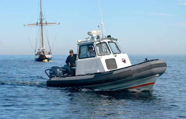
John Logan on the Nereid.

John has been involved in our research, conservation and education efforts for right whales since the partnership began in 1998.
In fact, it was John who first contacted us that year to investigate how we could work together on the issue of reducing the risks of vessel strikes to right whales. The unlikely partnership of biologists and an oil company working together has resulted in a conservation success story for right whales in the Bay of Fundy.


Carolyn Van der Veen on the Nereid.

Carolyn has been furthering the understanding of right whales through several right whale education campaigns online. Check out the "Fluent in Whale" game on Facebook, an inspiring video about our partnership on YouTube, and information about the program on their corporate website. Irving also promotes our Right Whale Research Program at their retail outlets in the Maritimes and New England.


September 14th was a less-than-bluebird day, but our guests were game for adventure on the choppy seas that the wind was stirring up. And wouldn't you know it that we observed the highest number of right whales in one day for the season? We had eight to ten individuals, many of them new for the summer! Some old-timers appeared, like Manta (Catalog #1507), Dollar (#1332), and Meridian (#1403). We also sighted three   younger whales; Catalog #3832, #3890, and #3808 (our first whale of this season).


Meridian, named for the wrapping head scar that remains from a severe entanglement event. Photo: Marianna Hagbloom

While being jostled around on the R/V Nereid, Amy Knowlton was able to snag two very valuable photos of Catalog #1331. We don't know when #1331 was born, but we added him to the Catalog in 1981. He was last observed during an aerial survey on November 26, 2011, when his right flank revealed new propeller cuts from an encounter with a small boat. Although we only caught a brief glimpse of #1331, his scars seem to be healing well! This sighting was an appropriate reminder that even though we've made enormous strides in reducing the risk of ship strikes from large vessels, educating mariners who sail on small boats about right whales and how they are vulnerable to encounters is still a relevant and important task.


The first vessel-based photographs of Catalog #1331's propeller scars show healing. Photo: Amy Knowlton

Before we began our transit back to land, we came across three humpback whales who put on a show for our guests! Have you ever seen two humpbacks breach simultaneously? Then you can imagine the amazement of everyone on the Nereid when all THREE humpbacks breached within less than one second of each other! Difficult to capture, below is a collage of this incredible event:


Three humpbacks breaching together! Photo: Amy Knowlton

We had such a rewarding day on the water that there really couldn't have been a better way to say thank you to our funding partners for their willingness to collaborate with us, and for the work they allow us to do. There will be a story on the success of right whale conservation and steps for future efforts in the Saint John Telegraph Journal on September 28th by journalist Jenifer Pritchett and photographer Cindy Wilson, who also braved the elements with us to learn more about right whales in the Bay of Fundy. Keep your eyes peeled for the article if it's distributed in your area!

- Marianna and Moira

9/25/09

#19: The Right Whale Team on CBC News

North Atlantic right whales were a feature story on the CBC this week. The story features some great footage of whales in Surface Active Groups and diving. There are also some interview clips of our Canadian team members, Moira and Yan.


Click here to watch the news story.

8/14/09

#4: 3 Days Straight on the Water!

August is proving to be a great month for surveys. We were able to get out the past three days! The winds were light Wednesday and Thursday and sighting conditions were excellent for surveying the bay. Conditions Friday were not as nice; the sea was calm in the morning, but quickly picked up early in the afternoon. Luckily, we were close to home when the weather turned sour. The ride home through the Grand Manan Channel was wet, but short and we made it to the dock at 2:30 p.m.

The Bay was as calm as a lake both Wednesday and Thursday. At one point Amy took a picture of her reflection in the water while the boat was moving. Such calm conditions allowed us to cover a good portion of the bay. We surveyed the southern part of the bay as far east as the shipping lanes.

On Wednesday, we sighted a lot of right whales near the shipping lanes and noticed an oil tanker in the outbound shipping lane. Moe radioed Fundy Traffic and notified them of the presence of right whales in the area. Fundy Traffic responded immediately, notifying the oil tanker of the whales position. We were all very pleased with how quickly Fundy Traffic responded.

There seems to be a lot of activity in the bay this year. Thursday, we sighted 14 humpback whales, 27 right whales and 407 harbor porpoises! That's quite an improvement compared to the 2 right whales we saw on our first day out. To date, we have sighted 33 individual right whales, which includes 7 of the 39 mother and calf pairs seen in the southeast calving grounds this past winter.


The weather is marginal for the next couple of days. We are watching the weather forecasts closely and hoping for the winds to drop low enough for us to get out on the water.

Stay tuned for more posts about who we've sighted and more exciting stories of our adventures in the Bay of Fundy!

- Jonathan

10/7/08

#33: Safer Havens for Right Whales in Canadian Waters


Vessel strikes are the leading known cause of right whale mortality from human activities. The shape, behavioral characteristics and habitat preferences of right whales make them especially vulnerable to being struck by vessels. Right whales are difficult for mariners to see, especially in rough seas and at night due to their low profile and dark coloration. Right whales are black, have a broad back and no dorsal fin. They move slowly and they spend extended periods at or near the surface. Typical behavior includes resting at the surface, social activity (i.e. courtship), skim feeding (i.e. swimming slowly near or at the surface as they filter zooplankton from the water), and nursing their young. They appear to not be aware or slow to respond to approaching vessels.

Roseway Basin--a place where right whales feed and socialize in the summer and fall--is located about 30 nautical miles south of Cape Sable Island, Nova Scotia and is one of two conservation areas for right whales in Atlantic Canada. The second is located in the Bay of Fundy, a summer and fall nursery area and feeding habitat. The 1993 designation as conservation areas by the Canadian government provided recognition, but no extra protection, to the whales inside the area boundaries. Vessel traffic was not excluded from the areas.

In the Bay of Fundy, a female calf named Calvin provided the impetus to relocate the Bay of Fundy shipping lanes; she was orphaned when her mother died as the result of vessel strike in 1992. In 2002, the International Maritime Organization (IMO) adopted an amendment to the existing shipping lanes. Implemented by Transport Canada in July 2003, the measure directed large vessel traffic around the aggregation of right whales reducing the probability of a vessel/whale interaction by 90 percent.

After the success in the Bay of Fundy, we turned our attention to Roseway Basin, the second summer and fall haunt of right whales. The process to reduce the risk of vessel strikes began with right whale sighting data collected in Canadian waters since the early 1980s (primarily by the New England Aquarium) and data crunching by Bob Kenney at the University of Rhode Island, and Christopher Taggart and Angelia Vanderlaan at Dalhousie University. The analyses of shipping routes and right whale sightings in the area by Dalhousie researchers indicated that, with the declaration of an Area to be Avoided (ATBA), the probability and risk of vessel collisions with right whales could be significantly reduced with minimal disruption to ship routes.

Although the total number of ships that actually transit the area was not known, an estimate was made using ECAREG (Eastern Canada Vessel Traffic Services Zone), ICOADS (International Comprehensive Ocean-Atmosphere Data Set) and AMVER (Automated Mutual-Assistance Vessel Rescue System) data sources. Based on these reporting systems, it was been estimated that a minimum of 1,700 ships navigate in and around the area annually and that many of the vessels are bound to or from ports in Halifax, Nova Scotia; Saint John, New Brunswick; the United States; the United Kingdom; Russia; Belgium; Norway and other European destinations and the route used generally reflects the Great Circle route from Europe and the East Coast of North America.

In April, 2007, the proposal for an ATBA designation south of Nova Scotia was submitted to the IMO by Transport Canada, and had a great deal of support from Canadian industry (e.g. Irving Oil and Atlantic Pilotage), government agencies (Transport Canada, Fisheries and Oceans Canada and the Canadian Marine Advisory Council), scientists (National Marine Mammal Peer Review Committee of DFO) and the Canadian Right Whale Recovery Team. Special accolades are due to Lindy Johnson of NOAA (pdf bio) for garnering support from the U.S. delegation to IMO.

In October 2007 the IMO adopted Canada's proposal to designate 980 square nautical miles of Roseway Basin as an ATBA. That means that vessels of 300 gross tons and above will be recommended to steer clear of the area from June 1 to December 31. The measure went into effect on May 1, 2008 and while the area will be recommended rather than mandatory, it was anticipated that the marine community would heed the recommendation and give way to the whales. There is always an option to return to IMO to seek mandatory measures if the recommended ones are not sufficient.

In 2008, the New England Aquarium and Canadian Whale Institute once again in collaboration with our colleagues at Dalhousie University initiated a marine stewardship recognition program for the Roseway Basin ATBA. Dalhousie scientists are monitoring, in near real time, vessel traffic in the vicinity of Roseway Basin to measure compliance with the ATBA through their Vessel Avoidance and Conservation Area Transit Experiment (VACATE). They are using Automatic Identification System (AIS) technology that transmits static, dynamic, and voyage related information including vessel position, speed, heading, destination, and vessel type. The VHF radio transmissions are received using a Bell-Aliant cell tower and antenna located near Cape Sable Island. Dalhousie scientists are using the AIS data to determine the routes of vessels in the Roseway Basin area, as well as calculating the additional mile and time cost for those vessels that avoid the ATBA in comparison to a standardized trip through the ATBA for each vessel. The same can be done for vessels that continue to transit the ATBA by providing alternative routing and associated cost. Although the ATBA is a recommended (i.e. voluntary) measure, the computer monitoring of vessel routes provides information on those vessels that are avoiding the area and thus provide a measure of compliance as well as those that are not and may not yet be aware of the IMO recommendation to avoid the area.

In the first month of implementation, preliminary analyses conducted by Dalhousie researchers found that about 70 percent of the vessels avoided the Roseway Basin ATBA. Researchers have also detected that some vessels that passed through the ATBA on one leg of their voyage avoided the area on their return trip. Seventy percent compliance in the first three months is a very good response from the maritime industry for this new measure. In these early stages, non-compliance is likely an issue of awareness of the new ATBA. Information placards like Caution Mariners are being distributed to mariners in Atlantic Canadian ports through port authorities, shipping agents,and harbor pilots to increase awareness of the implementation of these conservation measures.

The 2008 implementation of the IMO sanctioned Roseway Basin ATBA and the 2003 amendment to the IMO mandated Bay of Fundy shipping lanes are two examples of how New England Aquarium researchers and their collaborators are working with corporations and government to not only develop, but more importantly implement, conservation measures for right whales and monitor mariner compliance. These actions will promote recovery of right whales and last well beyond our lifetimes. What does this mean for right whales in Canadian waters? It means that the calves, like Calvin's first calf born in Florida waters in 2005, will have a safer haven in the Bay of Fundy in which to fatten and grow. And on Roseway Basin adult right whales will have a safer place to engage in the activities that result in more calves. Thank you to our partners in right whale recovery!

9/1/08

#20: Calvineers Visit: The Rescue

The Eagle Is Down, But Not For Long
While the Calvineers were on the Island Cruises Whale Watch from Campobello Island, NB, they witnessed the rescue of an eagle that was stranded in Cobscook Bay. See the previous entry, # 17, Calvineers Visit, Day 2, for a detailed account of the whale watch that day. The following is an account of the Campobello Whale Rescue Team's (CWRT) efforts to rescue a distressed bald eagle:

The news of an eagle that was in the water and unable to fly off came to Mackie Green, captain of the whale watch boat, Mister Matthew, over his VHS radio from another whale watch boat. They had unsuccessfully tried to help the eagle and knew that Mackie was part of the CWRT. Mackie took us to the struggling eagle and he and Robert tried to get a large life ring under the bird. Each time the eagle insisted on jumping off the life ring. After three tries they tried one of Meredith Houghton's suggestions, which was to tow a large log floating in the debris to the eagle so it could get on something natural. Good idea but the eagle would have nothing to do with it.

Meredith Olivari explained the event, "When we saw the poor eagle in the water I became sad, I felt so bad for it; trying to lift it's tired wings out of the water and swim back to the far-off shore. Meredith and I had some great ideas about how we could save the eagle and we were a little annoyed that the crew wasn't trying our ideas. Finally they tried one but it did not work."

Meredith Houghton gives an account of the rescue: "...we were lucky enough to witness something that hardly ever happens to a whale watch group! We heard over the radio that a bald eagle was stranded in the water, its feather's waterlogged and couldn't fly! We named it Perry, and it was trying desperately to swim to shore, but with the strong current, the eagle wasn't making much headway. Captain Mackie sped over to see what we could do to help the distressed animal. After trying many different methods, including a life ring, a log and a winter jacket, the CWRT came over to help. They got the eagle out of the water and ended up putting him on a beach where they could keep an eye on him until he flew away. It was so amazing to see the scientists and rescue crew at work, and it was such a good feeling when they saved the eagle, because we knew that it would be safe now."

As the eagle was rejecting the log the CWRT rescue zodiac came into view. When it was close enough to see the driver Meredith Houghton exclaimed, "Look! It's Moe Brown from the Whale House!" Moira (Moe) Brown is trained in all sorts of marine rescues and handles a boat expertly. As soon as Moe maneuvered the boat alongside the eagle her two colleagues put a bag over the eagle's head to calm it down and then carefully hoisted the disheveled animal into the rescue boat. Everyone cheered and there were a couple of tears noticeable also. The eagle did not have any broken bones and seemed quite vigorous. It was let go on a deserted beach where it walked up to some ferns and spread its wings to dry. The student scientists experienced yet another event that showed them how exciting being a scientist could be. Not only that, they were learning that woman scientists are very good at what they do. There is absolutely no reason why they, too, could not become a scientist who does great work in the field as well as the office.

Photo Captions:

1) Struggling Eagle
2) First Rescue Attempt
3) Moe and the CWRT Rescue Team

All Photos taken by Bill McWeeny